“Connemara is a state of light. Of fluent sky, flayed rock and flowering bog. Of storied lake and inlet and deep song. Of wind and wild.”
MICHAEL COADY
Listen to nature’s voice
Welcome to Connemara
National Park
Connemara National Park covers some 2,000 hectares of scenic mountains, expanses of bogs, heaths, grasslands and woodlands in County Galway. Some of the National Park’s mountains, namely Benbaun, Bencullagh, Benbrack and Muckanaght, are part of the famous Twelve Bens or Beanna Beola range.
Opened to the public in 1980, the National Park includes lands that once formed part of the Kylemore Abbey Estate, the Letterfrack Industrial School, and the private property of Richard ‘Humanity Dick’ Martin, who helped to form the Society for the Prevention of Cruelty to Animals. Learn more about our walking trails, unique habitats and our beautiful flora and fauna.
Boundary Map of
Connemara National Park
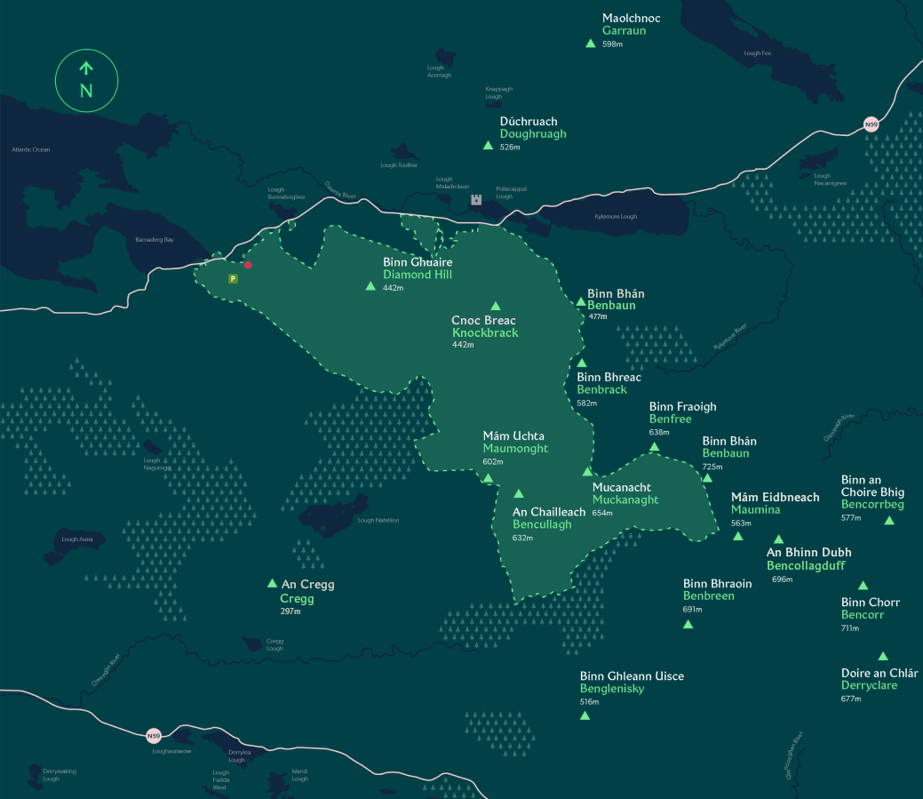
Area
S.P.A:
Location in Co.Galway

Legend
-
 Parking
 -
 Lake
Lake -
 River
River -
 N59
N59
-
 Mountain Peak
 -
 Kylemore Abbey
 -
 Visitor Centre
 -
 Park Boundary
This map is for illustrative purposes only and shall not be held conclusive as to the boundaries or their extent. Please note the Department of Housing Local Government and Heritage makes no representation or provides any warranty as to the accuracy, completeness or currency of this map. The use of this map, which may be altered or updated at any tiome without notice, is at the sole risk of the user.
News & Notices
NPWS opens new Connemara Pony Heritage Centre at Connemara National Park
7 November 2025
Hallowe’en Events at Connemara National Park
21 October 2025
Connemara National Park – protecting nature for forty-five years
10 July 2025
Picks of the Park
Heritage Breeds
NATURE AND CONSERVATION
Find out more about our conservation projects, as we help maintain and grow heritage breeds within the park, such as the renowned Connemara pony.
Diamond Hill Walks
WALKING AND HIKING
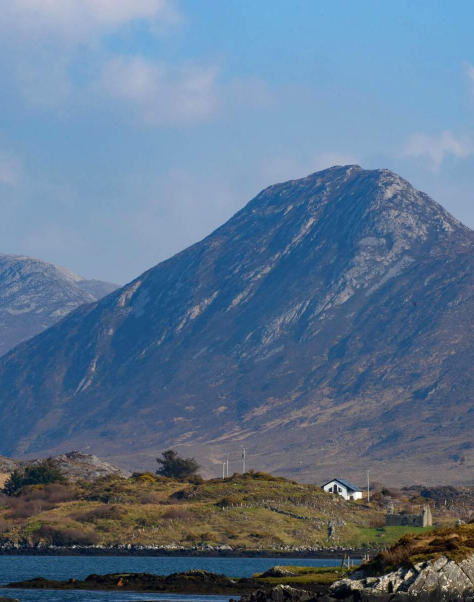
One of the highlights of the National Park is reaching the summit of Diamond Hill for panoramic views of Tully Mountain (known locally as Letter Hill), Kylemore Abbey and the Twelve Bens.
Self-guided Tree Trail
THINGS TO DO
Explore and discover the various tree species that can be found in Connemara National Park.
Walking & Hiking
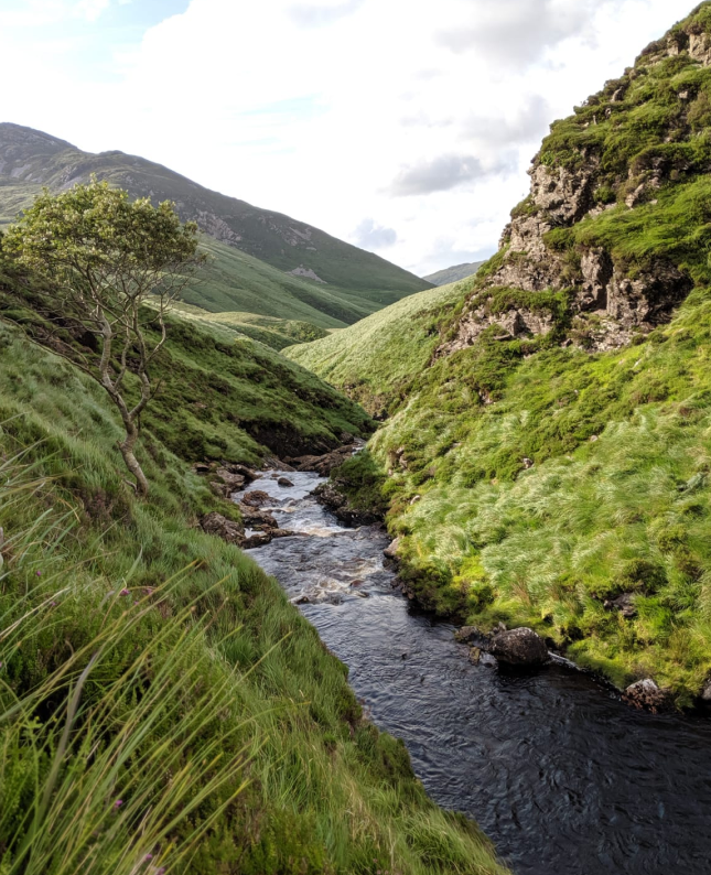
Connemara National Park includes part of the Twelve Bens mountain range, including Benbaun, the highest peak in Co. Galway at 725m. Explore our four walking trails and remember to check the weather before you set off and bring any essentials you’ll need.
Ellis Wood Nature Trail
Sruffaunboy Trail
Lower Diamond Trail
Upper Diamond Trail
– Visitor Centre
– Café
– Toilets
– Playground
– Picnic areas
– Education Centre
OPEN:
Year round
ADMISSION:
Free
OPEN:
9:00am–5:30pm
CLOSURES:
Christmas Day and St. Stephen’s Day
Please ensure you check weather conditions before visiting the National Park. The grounds will be closed during orange and red weather warnings.
Getting here
VISITOR CENTRE
OPEN: 9:00 AM – 5:30 PM
The Visitor Centre and main access for Connemara National Park is located near the village of Letterfrack along the N59. Entry to the park and visitor centre is free of charge. There is no charge for parking.
The National Park Visitor Centre is accessible by both public and private transport. There is no entry fee.
from GALWAY ~ 93km (VIA CLIFDEN)
Travel along the N59 to Clifden and then follow the directions above for travel from Clifden to Letterfrack.
from clifden ~ 15km
Take the N59 (Westport Road) towards Letterfrack. Before entering the village of Letterfrack you will see a sign for the National Park on the right hand side of the road. Turn right here and follow the road to the car park.
from LEENANE ~ 20km
Follow the N59 (Leenane Road) towards Leenane, remain on the N59 to Letterfrack. 200 metres after the village you will find the main entrance for the National Park on your left hand side. Follow the road to the car park.
from GALWAY ~ 82km (VIA INAGH VALLEY)
Travel along the N59 to Recess. Just after the village of Recess take the first turn on your right to travel down the Inagh Valley. At the end of this road turn left for Letterfrack. This is the Letterfrack-Leenane Road. Continue through Letterfrack and approximately 200 metres from the village your will find the main entrance to the National Park.
from WESTPORT ~ 53km
Follow the N59 (Leenane Road) towards Leenane, remain on the N59 to Letterfrack. 200 metres after the village you will find the main entrance for the National Park on your left hand side. Follow the road to the car park.
Bus services for Letterfrack operate from Clifden and Galway.
Bus Éireann – to letterfrack
from clifden & galway See Route No.419 for timetable details:
citylink – to letterfrack
from clifden & galway See Route No.923 for timetable details:

